Description
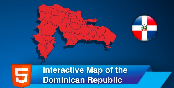
The interactive map of the Dominican Republic is a Scalable Vector Graphics (SVG) template containing all thirty-one provinces plus all three islands. The map is clickable and responsive, with regions popup on hover. The template gives you an easy way to install and customize a professional looking. You can embed the map in your website, link each region/city to any webpage, or make a hover popup with information. You can easily copy and paste the code to your website.
{inAds}
Features
- SVG Graphics—Resolution independent: responsive and fully resizable
- Fully Customisable—Desktop and Mobile ready
- Provinces can be customized independently (colours, hover information, hyperlink, etc).
- The source consists of HTML,CSS and JS files.
- Easily customized
List of clickable provincies
- Azua
- Bahoruco
- Barahona
- Dajabón
- Distrito Nacional
- Duarte
- Elías Piña
- El Seibo
- Espaillat
- Hato Mayor
- Hermanas Mirabal
- Independencia
- La Altagracia
- La Romana
- La Vega
- María Trinidad Sánchez
- Monseñor Nouel
- Monte Cristi
- Monte Plata
- Pedernales
- Peravia
- Puerto Plata
- Samaná
- Sánchez Ramírez
- San Cristóbal
- San José de Ocoa
- San Juan
- San Pedro de Macorís
- Santiago
- Santiago Rodríguez
- Santo Domingo
- Valverde
| Compatible Browsers | IE6, IE7, IE8, IE9, IE10, IE11, Firefox, Safari, Opera, Chrome, Edge |
| Software Version | HTML5 |
| Demo URL | |
| High Resolution | Yes |
| Files Included | JavaScript JS, HTML, CSS |
| Video Preview Resolution |